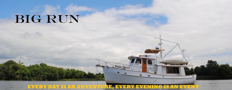
Have you ever seriously thought about living your dream? We did and now we are full time cruisers onboard M/V Big Run. Everyday is a new page to be written in our ship's log as we travel to new places and revisit some ol' favorites. Come along and share our experiences and journeys.

Comments to postings are welcomed. We have elected to moderate all comments before the comment is published, so be patient, you comment will be posted.


Welcome to our Adventure
Showing posts with label ICW. Show all posts

Tuesday, October 2, 2012

Brunswick, GA


     In celebration of our reunion with Ken & Cindy (S/V Meant To Be), Mother Nature provided us with a spectacular "event" over Brunswick, GA.

Saturday, September 29, 2012

Swimming Lessons

     After 8 glorious days on the Waccamaw River at Butler Island, we slowly made our way south to Cumberland Island, another one of our favorite ICW stops.  As with previous stops, we have made numerous hikes through the live oaks and on the beach.  I have often wondered what live oaks are called when they die off - Firewood!  Back to the business at hand.  One of the many benefits of Cumberland Island has been the wildlife.  This year has not been a disappointment with the wild horses, turkey and other creatures.  Yesterday was quite a surprise for us as we sat on the boat watching the tide go out, very much like watching paint dry.  Except this paint drying episode had a twist to it.  To the west of our anchorage is a shoal that at low tide is exposed.  At half tide I kept looking over at a formation on the shoal.  Although partially submerged, it kept my interest.  As the tide receded even more, I was drawn into a curious mode and would scan it more regularly with the binoculars.  Although it was only 150 yards from the boat, I was not able to get a good view because of the way the object was laying.  The key word here is laying.  Finally at low tide, when the object was fully exposed I discovered it was an alligator laying on the shoal.  It appeared to have something in its mouth.  Then, all of a sudden as on cue, with a violent lift of its head and partially opening of its jaws repeatedly, the alligator started to swallow its prey.  We could not decide what the alligator was having for lunch but inquiring minds wanted to know.  Off to the dinghy for a closer look.  As I was getting into the dinghy, the alligator must have caught wind of my plans and slowly lumbered into the water.  I was able to get the dinghy close to the alligator, about 30 yards, but I don't think the alligator appreciated my interruption of its lunch and just stared at me.  I slowly backed off and returned to the boat but not before getting a few decent pictures of the alligator in the water.  Cancel today's swimming lessons.

Basking in the sun while savoring lunch

Still working on swallowing lunch, gator needed something to wash lunch down.

The partially open mouth convinced me to back off.


Saturday, September 8, 2012

$10,000 Fine


    What's wrong in the above photo?  If you are a boater and have navigated through bridges, you should have spotted it immediately.  If you're not a boater, welcome to ICW Bridges 101.  Boats have 2 drafts, the all important one is "What floats your boat?".  Big Run needs 4'6" of water and then we're still not going anywhere.  So we need 5', Sharon prefers nothing less than 6'.  The second draft is your air draft or "How tall is your boat?".  Measured from the waterline to the top of the tallest fixture is your "air draft".  Big Run's tallest item is our VHF antennas yielding us an air draft of 28'.  It is very critical to know both of your drafts.  However, your draft (water) when approaching a bridge is not critical because you're probably already and should be in the bridge's navigation channel.  Here is where the air draft becomes so important.  Most bridges have boards at each entrance to the bridge's fender system.  On the boards are the bridge's clearance based on the tide height.  In the above picture you would read the clearance at the waterline.  But in the above picture of the boards for the Barefoot Landing Swing Bridge in South Carolina, one would have to question "Which board is positioned correctly and do I trust the dude that installed the boards(s) can read a tape measure?".  The prudent sailor would hail the bridge tender.  I almost forgot one other thing.  If you request a bridge opening but your boat would clear the bridge span without an opening, you are subject to a $10,000 fine.

Saturday, April 21, 2012

The Pasquotank River

     When you depart the Alligator River in North Carolina and are heading north, you must make a navigational decision - ICW Route 1 through Coinjock or ICW Route 2 through the Dismal Swamp.  We have always chosen Route 1 through Coinjock, whether we were heading south or north.  However, there is always an exception and that would be our migration north this spring, when we chose Route 2.  When you depart Elizabeth City, NC for the Dismal Swamp, you travel north on a river to access the Dismal Swamp Canal.  There is an abundance of wildlife on this river as shown in the photos below.  This river is our third installment in the Best Scenic Waterways.  This river is the Pasquotank River.


M/V "Rust Bucket"

     The only reason this boat qualifies for the "Boats of Interest" label is because the twin 150 Mercs mounted on the stern are worth 25 times more than the value of this rust bucket.

Thursday, April 19, 2012

Goose Creek

     We have passed through this waterway many times, but never on a sunny day.  Although each day was grey and overcast, it was always a beautiful and scenic waterway.  Located in North Carolina just south of the Pamilco River, the creek is about 5 miles long and is packed with swamps, marshes woodlands and small tributaries.  It has earned our title of best scenic waterway, this is Goose Creek.


Wednesday, April 18, 2012

A Fighting Chance

     We've been slowly making our way north since our departure from Stuart, FL on the 30th of March.  Some days we cruised for 40 or 50 miles.  Some days we cruised 60 or 70 miles.  Sometimes we took the day off.  We cruised for 5 days with our good friends Rick, Deb & Izzy (M/V Broulee).  One day we cruised for 87 miles with the help of a flood tide so that we could rendezvous with our good friends Joe & Ann on S/V Short Walk.  Since reuniting with Short Walk on the 9th of April, we have been cruising with them.  They have been taking side excursions to different towns to visit friends.  We have been meeting some of our friends on the waterway.  Just last night I went up to the pilothouse just before sunset and spotted M/V Epilogue, another Krogen 42, heading off for a different anchorage.  They had not seen us because of the other boats that had anchored with us.  We hailed them on the VHF radio and managed to catch up on some things.  This morning Epilogue stopped by for a drive-by hello.  We hadn't seen Phillip and Connie for almost 18 months and we managed to say hello and spend a few moments "together" albeit from 30 feet away as we each stayed on our respective boats. 
     If our planning pans out, remember Jello, Short Walk should catch up to us on Thursday morning in our current anchorage on the Alligator River. Our anchorage is on the south side of the Albemarle Sound.  This body of water has always been our arch enemy because we do not have stabilizers which would prevent us from rolling from side to side.  The Sound is oriented in a east west lay and with its shallow depth can provide for some very rough seas when the winds are strong.  Big Run always handles best when she is very heavy so yesterday we topped off the fuel and fresh water tanks to give us a fighting chance.

Wednesday, April 11, 2012

ICW Sunrise

M/V Broulee departing Cumberland Island (4-5-2012)

S/V Short Walk on the hook at Butler Island (4-11-2012)

Tuesday, April 10, 2012

Photo Opportunity

     Just this morning I was on the phone with Rick (M/V Broulee) discussing the "catch of the day" when we hauled the anchor on Monday, the previous day in Port Royal, South Carolina (see blog entry "New Challenges" 4/9/2012).  Rick said it's not a good place (South Carolina) to have to dive on a fowled anchor because of alligators in the south.  We have never seen alligators on the ICW,  until today.  We were traveling north in South Carolina near Casino Creek at mile marker 425 when Joe on S/V Short Walk reported over the VHF "Alligator on the starboard side"!  Say no more, I asked Sharon to take the helm and with camera in hand I was off to the foredeck.  As we draw closer the alligator starts swimming for the center of the ICW, right in front of the boat.  Wow, what a photo opportunity!
The alligator casually swimming for the center of the ICW and towards the front of the boat.

Patiently waiting for Big Run to pass.

Monday, April 9, 2012

New Challenges

     "Everyday is an adventure......." so goes our motto, and with each day comes a new challenge, but at 7a.m. when I'm hauling the anchor I don't need any new challenges.

The one that did get away.  Length - 16 feet.  Weight - extra heavy.  New Big Run record.

Saturday, April 7, 2012

The Speed Of Light

     After sitting in an anchorage on Duplin River, GA waiting for a blow to pass through on Friday, Sharon and I decided to get an early start this morning.  At 0645 I went up on the bow to pull the anchor only to find a surprise waiting for me on the anchor chain.  Friday was full moon and with the full moon comes astronomical high tides.  When you have high, high tides as we did last night, the old growth reeds from last season are all swept out of the marsh lands and deposited onto the waterways.  Or, as in our case, snagged on the anchor chain and bow.  (See photos below)
This picture does not convey how large the collection of reeds was on the anchor chain.

With the anchor still deployed we were able to motor to port and then back up to shake part of the  pile free.
      Later in the day as we made our way north through the Georgia marsh lands, we were always fighting the currents of the tides.  Sometimes the currents were on the bow, which slowed our speed over ground to 4.5 MPH.  But when the currents were on the stern, we made very good time.  Big Run is limited in speed due to hull design.  It's a full displacement hull, and it's called hull speed.  Hull speed is the measurement of the vessel through the water not over ground.  It doesn't matter how much horsepower you throw at it our maximum hull speed is around 8 MPH.  Today, with the current on our stern, we broke the 8 MPH barrier and there was cause for celebration.  In fact here is the analysis of our speed over ground with the currents pushing us today:

         9 MPH - now we be sailing!
       10 MPH - now we be flying!
       11 MPH - warp speed Scotty!
    11.5 MPH - for a trawler that's faster than the speed of light!

Saturday, September 24, 2011

Thank You Captain

     Despite the rain all day, today was a pleasure to be on the Intracoastal Waterway (ICW).  We managed to get an early start at 0715 this morning at Hospital Point, Mile 0 on the ICW charts.  As with last year, we took the Virginia Cut, route 1 of the 2 available routes to the Albemarle Sound, which by the way is how we judge all waters when it comes to wind generated waves.  We didn't make it to Albemarle Sound today, but we did make it to Buck Island, our anchorage south of Coinjock, NC.  In the 58 miles we traveled today we only encountered 5 other boats heading south.  Last year we started our adventure 3 weeks later in mid October and were surrounded by many boats, 20 or more, on this the first leg.  This year we traveled for miles at times and never was passed by another boat.  We did have one "Chucklehead" who thought because we didn't slow down for him to pass us, he didn't have to slow down either.  Obviously he does not know the rules of the road or how to execute an easy pass, aka slow pass.  An easy pass first starts with the boat wanting to pass you contacting you by VHF radio.  After the details have been worked out, port or starboard side pass, the passing boat will approach your stern, at which time you the lead boat will slow down to idle speed.  The boat passing the lead boat slows down and passes on the predetermined side at a slow speed just faster than the lead's boat idle speed so as not to create a wake that would rearrange your galley from a wake that rolls you from side to side.  Having any part of your boat's interior rearranged by another boat's wake is not a good thing.  It's bad enough that Mother nature does it from time to time.  After he has passed you, you fall in behind his stern and the other boat resumes it's speed.  One boat that passed us today executed a perfect text book easy pass.  Thank you Captain.

Friday, April 8, 2011

No Injuries

     When your car has a breakdown, you can pull off to the side of the road.  When your boat has a breakdown, you probably can drop anchor where you are and start repairs.  When your airplane has a breakdown, you can usually glide in for a landing on the road or a field.  But when your helicopter has a breakdown, you have to land immediately.  This helicopter was flying over the ICW when all of a sudden it turned around and made an emergency landing in what appeared to be a small clearing in front of these homes along the ICW.  This all happened less than a 1/4 mile from us.  The bewildered homeowners came out with their cameras and cell phones and started taking pictures, just as we did from the boat.  It appeared it was a safe landing and that there were no injuries.

Sunday, February 27, 2011

20,000 Pasty White Kids

    Upper Photo - One of hundreds of Man-of-Wars we saw as we crossed the Straits of Florida.
 
      Saturday was the weather window we needed to make the crossover of the Straits of Florida.  Our plans were to go back to Miami to check in, but mother nature said otherwise.  Due to the winds and the ocean surge we were once again required to adjust our heading to another port as with other crossings, this time Port Everglades (aka Ft Lauderdale).  As we approached  Florida's east coast it became quite the spectacle, audibly and visually.  As soon as we got within 20 miles of the coast ,the chatter on VHF channel 16 was non-stop.  Then when we were about 5 miles from the Port Everglades inlet, the boat traffic became very heavy.  What were we thinking of when we decided to return on a Saturday.  Oh, I almost forgot, we are boaters and very weather dependent.  The madness we saw at the inlet continued all the way up the ICW to our anchorage at Lake Sylvia.   
     After clearing customs by phone we had to go to the local immigration office and appear in person.  Off we  go with Rick and Deb in their dinghy to a local marina so that we could catch a taxi to Port Everglades.  The taxi ride and the immigration office was uneventful.  However, what made this most interesting is that it is the start of Spring Break.  Did you ever see 20,000 colleges kids from up north in Florida in February?  Yea - 20,000 pasty white kids.

Lower Photo - M/V Broulee heading for Port Everglades (Ft. Lauderdale)

Wednesday, December 8, 2010

Payoff The National Debt

     Today was a very long day for us on Big Run.  We started the day at 7:35 a.m. by weighing anchor to a very cold morning  at Manatee Pocket (Port Salerno, FL).  Once again we were heading south on the ICW.  One of the obstacles we would encounter today were the numerous bridges.  I guess the days of bridges with 65 feet of clearance in the center span are behind us.  Some of the bridges had 35 foot clearance which we can navigate without requesting an opening.  Big Run's air draft is 28 foot including the 2 VHF antennas.  And then there were the bridges which required us to contact the bridge tender on VHF and request an opening.  In total, there were 19 bridges, and of those 19 bridges 15 needed to be opened for us.  The real challenge is calculating your distance and speed to the next bridge for some of those bridges only open at certain times.  Some bridges open on the hour and half hour, others open at the quarter hour before and after the hour.  If you didn't calculate your speed and distance correctly you either got to the bridge to early or you miss the opening altogether.  There were some that opened on request. They're our favorites. And so our day went, bridge after bridge, 19 bridges and 60 miles later we finally dropped anchor at 5:15 p.m.
      We also had a very pleasant surprise today as we passed through Jupiter, FL.  This was the first time that we were able to see the bottom.  Very interesting to see the bottom after all the miles we have traveled in murky waters.  Despite being in 14 feet of water, the water was crystal clear in that we could see the bottom as we motored on at 7 MPH.  We also found that our anchorage for the evening, Lake Boca Raton also had clear water.  That was the first time I was able to drop and set the anchor and could see exactly how our gear worked.  The Chesapeake Bay never had water so clear that you could see bottom.
      Another observation today was the the extremely lavish mansions on shore and the numerous floating mansions.  We have always seen nice homes along the ICW but not like today in North Palm Beach, Palm Beach, Delray Beach, Boca Raton.....Get the drift?  When I say floating mansions we are talking 160 feet plus - mega-yachts.  To sum up the area I said " Too many people with too much money" and Sharon said "If you could convert all the mansions and mega-yachts to cash you could pay off the national debt!".

Monday, November 15, 2010

Leading the Blind

     On Sunday, Sharon and I anchored on Frederica River, just north of Brunswick, GA.  This was intentional so that we could stage ourselves to arrive early Monday morning at Brunswick Landing Marina.  Waiting at the marina was a new raw water pump I had ordered from American Diesel Corporation.  Also, we needed to get to that "marina" store to get some new battery cables and other things we had ordered on line and had dropped shipped to that store.  But that is another story we will not discuss at this time.  So on Monday morning we got a nice early start down the Mackay River towards St. Simons Sound.  As we entered the Sound, a sailboat and trawler joined us for the crossing.  As we were crossing the Sound, we could hear the sailboat and trawler conversing on the VHF radio.  At one point the gentleman on the trawler asked the lady on the sailboat for their location.  She replied she did not have an exact location and that he should follow the trawler (Big Run) in front of them.  As we approached the route for the ICW we turned northwest to go up the Brunswick River and onto the East River.  Again the gentleman on the trawler radioed the sailboat for a location and asked what bridge was that ahead.  The woman did not know their location but remarked the bridge was the Jekyll Island Bridge that had been under construction last year when they came through.  As we passed under the Sydney Lanier Bridge  at Brunswick the conversations continued as the boats followed us.  The gentleman on the trawler continued to ask for their present location but to no avail.  Shortly after passing under the bridge we turned to starboard to go up the East River and on to the marina.  The trawler and sailboat did not follow us. They continued up the Brunswick River.  About five minutes later Sharon heard a second male voice come on the radio to explain to the trawler that they were turning around.  I guess they were lost because they assumed we were transiting the ICW .  I guess you can say it was a case of the "not-so-blind" leading the blind.

Sunday, November 14, 2010

Miscellaneous Photos

.....feeding time
   
.....another great sunset
 

.....Bond, James Bond


 .....every Captain's nightmare
 
.....this will keep most people out!

Friday, November 12, 2010

Driving in the Snow

     Previously I had discussed some of the challenges of anchoring on the ICW and its tributaries.  To get to those anchorages you must navigate through waters of varying depths, but more importantly through the currents caused by the tide.  There have been times we were cruising at 1700 RPM's on the engine tachometer which  typically translates into a boat speed of 6 knots, however we were doing 9 knots.  The operative word is "typically", but these are not typical times.  There is no way this boat could do 9 knots on her own.  There have also been times we have been taching 1700 and only doing 4.5 knots, again thanks to the currents.
      There are 2 incidents that stand out in my mind very boldly - Snow's Cut and Elliott Cut.  We transited both of these narrow high banked cuts against the tide.  Both times we felt as though we were going uphill! Snow's Cut was our first and we were fortunate to have another boat to follow.  Elliot Cut was much different.  We had just cleared Charleston SC harbor and headed up Wappo Creek towards Wappo Creek Bridge.  We did not require a bridge opening due to our air draft being low enough.  The 2 sailboats one mile ahead did require a bridge opening.  After the bridge is a 1-2 mile section before you get to Elliott Cut.  We maintained our distance behind the sailboats.  That distance was quickly reduced to feet after the sailboats hit the ripping current coming through the cut.  Before we knew it we were 100 feet to stern of the sailboat who was having great difficulty with the 4 knots + (read "plus")  of current coming through the cut onto his bow.  We actually had to throttle back to prevent colliding with the sailboat.
     Perhaps the most fun you can have with the currents is when the tide is going in or out and a river is dumping water onto your body of water.  First, the current hits the bow and tries to push it over, and you counter steer a little to correct the boat's attitude.  The fun really starts when that same current hits the stern.  The effect of that current on the stern causes a reaction unlike that of the bow.  You really have to be prepared to counter that effect with a drastic turn of the wheel.   You know, like when you have to counter steer while you're sliding around the corner while driving in the snow. 
Copyright 2007 and Every Year Thereafter.

All Rights Reserved Including Photo Images and Text.

In Other words - You May Not Use it, Copy it or Steal it!