Have you ever seriously thought about living your dream? We did and now we are full time cruisers onboard M/V Big Run. Everyday is a new page to be written in our ship's log as we travel to new places and revisit some ol' favorites. Come along and share our experiences and journeys.

Comments to postings are welcomed. We have elected to moderate all comments before the comment is published, so be patient, you comment will be posted.


Welcome to our Adventure

Friday, December 31, 2010

Paradise

     It was on December 21st that we came east to Spanish Wells and Eleuthera Island.  We had been weather bound in Spanish Wells for too long despite having a great Christmas weekend.  And after working our way south on Eleuthera Island and making stops at Hatchet Bay Harbour,  Governors Harbour and Rock Sound Harbour, we decided today was the day to make a move east over to the Exumas.  The Exumas are a chain of islands and may be the heart of the Bahamas experience.  To cross over from Eleuthera Island to the Exumas you must cross the Exumas Sound.  So, after much debate and reexamination of the numerous weather models we had, we started out the morning at Rock Sound Harbour at 6:30 am to make the crossing.  All of the weather models called for easterly winds in the 15 MPH range.  One marine forecast called or 2-4 feet seas while the rest called for 1-2 foot seas.  Within a couple of hours we were on the sound and found 2-4 easterly waves and rollers coming out of the southeast.  In other words, the seas were confused.  The Exumas Sound crossing was to be 25 miles from Powell Point to Normans Cay. After the first 5 miles, we made a course correction from a heading that would take us to Normans Cay to a heading a little further north to Ship Channel Cay.  This would eliminate the beamy sea causing us to roll.  It turn, we now had a following sea and from time to time we would ride the waves like a surfer on his surf board.   The Exuma Sound has depths that average around 1400 feet deep.  As we approached Ship Channel Cay the bottom quickly rose up and with that came even more confused seas.  We had the waves driven by the easterly winds and the ever persistent swells from the southeast.  And for good measure let's add in currents from a falling tide. What do you have?  A roller coaster on water.  So, here we are at Ship Channel Cay and about to start a new adventure.  The adventure I have been waiting for ever since December 17th when we first made the crossing from Miami.  We are on the hook at a Bahamas Island with crystal clear water and a sandy beach.  Can you say "Paradise"?
 Above - The Western shoreline of Ship Channel Cay.

Thursday, December 30, 2010

65 Degrees


 Left - Large cave on west coast of Eleuthera Island south of Governors Harbour.


 Right - Note how the ocean has undercut these formations.  This is typical of the Eleuthera  Island coastline and surrounding islands.


      When your hailing port is Rock Hall, MD you must go to Rock Sound, Bahamas.  We left Governors Harbor at 9 a.m. after a leisurely start to the day. Today the ocean was nearly as calm as yesterday in the start of the cruise down Eleuthera Island.  Then in late morning the sun came out and the winds calmed down and so did the sea.  The western coast of  Eleuthera Island has some very interesting formations, outcroppings and vegetation as seen in the above photos.
     On arrival to Rock Sound Rick, Deb, Sharon and myself went into town.  Our first trip was to the customs/immigration office again.  We found the customs office but were told the immigrations office was at the airport, too far to walk.  Next order of business was to find  Ocean Hole.  The Ocean Hole is a "crater" filled with brackish water and its water fluctuates (tide) with the ocean that surrounds the island.   It has been suggested that Jacques Cousteau had tried to find the underground link between Ocean Hole and the ocean surrounding the island but he never was able to make the discovery.   The town has turned  Ocean Hole into a very nice park.  Ocean Hole is open to swimming,  but the only thing swimming today was the fish.  I don't know what temperature the water in Ocean Hole is, but from the weather reports I know the ocean temperature is 65 degrees.


Left - This is a photo of Ocean Hole at Rock Sound Settlement.


Right - You would think this photo was taken at an aquarium.  Actually, these are fish swimming in the Ocean Hole at Rock Sound Settlement.

Wednesday, December 29, 2010

$45.00

    Early morning photo of M/V Broulee on the hook at Hatchet Bay Harbour.  Note - that's Izzy at the pilothouse heading to the foredeck.


The narrow channel in/out of Hatchet Bay Harbour is flanked by these formations.  The channel at 80 feet wide leaves no room for error.

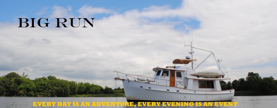
 Sharon relaxing while heading to Governor's Harbour.

     Today was not your typical day, although we did have a great start.  We left Hatchet Bay Harbour around 9 am for Governors Harbour.  If was a beautiful day so we piloted the boat from the flybridge and, because we were towing the dinghy, we cruised at about 5 knots.  
    We arrived at Governors Harbour around 1 pm and immediately had lunch before going ashore.  Rick and Deb on M/V Broulee immediately got into their dinghy and took Izzy ashore.  Before we could finish lunch Rick came racing back to the boat.  Not thinking much of what we just saw, we finished lunch and started our preparations to go ashore.  On our dinghy ride to shore we stopped over at M/V Broulee to talk to Rick and Deb.  When we arrived at the boat we saw Deb with her leg propped up and Rick tending to her injured leg.  Long story short, as Deb was taking Izzy on shore she slipped on the wet steps at the government dock and busted her shin open.  We left Rick and Deb to go ashore and find a doctor's office or a medical center.  Our first stop was at the customs office for 2 reasons, first to find a doctor and secondly to find if there was an immigration office.  Paydirt - yes to both questions.  So I radioed Rick with our portable radio and gave him directions to the doctor's office.  We then headed to the immigration office looking to get an extension to our permits.  No such luck.  So Sharon and I headed out to see the town.  As we left the immigration office we saw Rick and Deb leave their boat for the doctor's office.  The dock we had directed them to was not usable so we directed Rick by radio to a boat launching ramp.  Sharon and I  hurried over so that we could be of assistance to Deb getting out of the dinghy.  About a one half mile walk later and Deb was at the medical center where she received 4 stitches to close up her shin.  Deb was feeling no pain so we went shopping.  
     At the local grocery store we bought 5 pounds of flour for $3.75, although we could have spent $4.75 on the Gold Medal brand of flour.  Bread was $4.14 a loaf, which we passed on, Sharon has started making her own bread.  A few stops later and we all headed back to our boats.  Sharon and I had to walk around the harbour to get back to our dinghy.  We had decided to dinghy over to where Rick and Deb had gone ashore when Deb needed medical attention.  We needed gas for the dinghy and there was a gas station within 100 yards of that beach landing.  Did I tell you everything is 4 dollars - gas is $4.75 gallon.  The only bargain in town was the top notch medical attention Deb received for $45.00.

 Deb departing Medical Center after receiving 4 stitches on her right shin.

Tuesday, December 28, 2010

Happy Sailors

     I could not stand it anymore.  We pulled up stakes yesterday and left the marina at 2:20 p.m.  The wind had died down enough for us to make our way back to an anchorage we went to before taking up residence for 5 days in Spanish Wells.  It was good to be back cruising on the water and to drop the hook again in Royal Island Harbor. Then this morning we had the alarm set for 6 a.m. so that we could head down through Current Cut that separates Current Island from Eleuthera Island.  However, before we got to Current Cut, M/V Broulee and M/V Cocoon Too joined us after they had departed from the marina this morning in Spanish Wells.  M/V Cocoon Too is heading to the Exumas while M/V Broulee and Big Run head over to Hatchet Bay Harbour.  We have made plans to cruise with Rick and Deb (M/V Broulee) for a while, after all they have a dog.  So the anchor has been dropped at Hatchet Bay Harbour and Bob & Sharon are once again happy sailors.
 Above - Western "shoreline" of Eleuthera Island as we approached Hatchet Bay Harbour

Below - Entrance channel to Hatchet Bay Harbour - charted to be 80 feet wide.   

Monday, December 27, 2010

LESS WIND

     I didn't ask for anything this Christmas, I didn't want to be greedy.  After all we became full-time cruisers and it doesn't get any better than that.  Sharon didn't want anything for Christmas either.  However a few weeks ago in early December I jokingly told Sharon that I would give her the Bahamas for Christmas.  So we made it to the Bahamas and had Christmas with a new friend here at Spanish Wells.  How cool is that?  We  had planned on leaving Spanish Wells on Sunday December 26th.  That didn't happen and we probably won't be leaving today because of the weather.   The problem is being generated by a very large low pressure that is now east of New York City.  Yeah, it's reaching that far south to the Bahamas and beyond.  But it is now time to ask for something and I hope Santa takes late requests.  I do believe in the Spirit of Santa and I have always told our children that I do believe in the Spirit of Santa when they would ask me about Santa.  So here goes - Santa, I have been a good boy.  May I please have some fair weather with LESS WIND?

Saturday, December 25, 2010

Merry Christmas

     Season's Greetings from Spanish Wells, Bahamas.  Sharon and I would like to wish all of our family and friends a very Merry Christmas.  We also wish  you a very Happy New Year.  

Friday, December 24, 2010

7-10' Swells

     Thanks to our friends Rick & Deb on board M/V Broulee, we have some action video of Big Run making the crossing on the North Providence Channel from Chub Cay to Little Egg Island. on December 22nd.  The weather was perfect and the seas were very good except for the 7-10' swells.  Movie credit - Deb on M/V  Broulee.

Thursday, December 23, 2010

Boating Family

     Today was spent exploring Spanish Wells with our new friends.  Pictured above is (left to right) Rick & Deb (M/V Brouleee - Kadey Krogen 42) and Phyllis and Tom (M/V Cocoon Too - Kadey Krogen 48).  In the afternoon Phyllis and Tom introduce us to their friend Chris who lives on Russel Island which is next to Spanish Wells on St. Georges Cay.  Chris is a retired harbor pilot who has lead a very interesting life and has shared some of those experiences with us.  Chris has graciously invited all of us to his home.  We have been invited over for a steak BBQ on Christmas Eve   We have also been invited to Chris's house again on Christmas Day for dinner which will be followed by a fireworks display presented by the community of Spanish Wells.  It should be quite an evening, the fireworks will be launched from a barge about a 1/4 mile from Chris's house.  Although we will not be spending Christmas with our family, this Christmas shall be an interesting one with our  new boating family.

Wednesday, December 22, 2010

M/V Broulee


     This is M/V Broulee, a 1994 Kadey-Krogen 42 widebody, hull #181. She is crewed by Rick, Deb and Izzy. Izzy, a 2-year old black labrador retriever, is the boat security officer and entertainment committee. M/V Broulee is shown here crossing the Northeast Providence Channel on the way to Spanish Wells in the Bahamas.

Tuesday, December 21, 2010

Departing In The Dark

     We had another early start today so that we could cross Grand Bahama Bank to Chub Cay.  (In the Bahamas, cay is pronounced key.The alarm went off at 5:00 am for a departure at 6:30 am.  The journey took 12 hours and 15 minutes and we traveled 89 miles.  One of the interesting points of the trip was that the Grand Bahama Bank crossing was 58 miles long and the water depth averaged 14 feet deep and every mile of that was beautiful clear water and you could see the bottom.  As we left the Grand Bahama Bank we entered the Northwest Channel where the water is charted at depths of 500-2500 feet deep.  Our depth sounder will shut down when it reaches 200 feet of depth.  The deep water is of a blue color that I have never seen  before.
      Early in the journey we spotted a large shark around the boat.  Shortly after spotting the shark we hailed our friends on Monk's Vineyard to learn they left the marina at 7:30 am.  They informed us that most of the boats at the marinas had left by that time.
     We dropped anchor at 6:45 pm and will be departing Chub Cay in the dark.  Our planned departure is 5:00 am so that we can beat the winds as we cross the Northwest Providence Channel to Spanish Wells.  I guess we will be setting the alarm for 4:00 am.  I am sure it will be worth it.  We arrived in the dark at Chub Cay and we will be departing in the dark.  

Monday, December 20, 2010

Black Labrador Retriever

     Today was a very busy day around the marinas on North Bimini Island.  Not only for Big Run but also for our companion boats for the last week.  All boats in the numerous marinas were busy getting ready to leave tomorrow with the next weather window.  
     Our relationship with our companion boats started last Sunday when we met Michael & Jana (M/V Second Star) and Gerry & Linda (M/V Monk's Vineyard).  We had teamed up with them to make the crossing to the Bahamas (Bimini Island).  It was pleasure to be with these boats and their crews.  They brought with them the knowledge and experience to help us make the crossing.  However, all good things must come to an end, but only temporarily.  Second Star and Monk's Vineyard will be departing North Bimini for Nassau tomorrow.  We will be departing a little earlier for Spanish Wells.  Sharon and I sincerely thank Gerry, Linda, Michael and Jana for "taking us under their wing".
     We have now teamed up with two other boats.  Both boats are Kadey-Krogens (KK).  Rick and Deb are on M/V Broulee a 1994 widebody KK 42.  The other Krogen is crewed by Tom and Phyllis.  Their Krogen is a 48' Classic, which strongly resembles our KK 42, just 6 feet longer.   If my memory serves me well, these two crews have more than 10 years combined cruising the Bahamas.  I sure hope I can learn something from them as I did with Second Star and Monk's Vineyard.  On another note M/V Broulee has a bonus feature that puts the icing on the cake, Izzy, a 2-year old black labrador retriever.

Saturday, December 18, 2010

Friday, December 17, 2010

Immigration and Customs Offices


      The alarm was set for 4:45 am.  This was the day, the weather window was here.  Our hopes were soon to become reality.  We are heading to North Bimini in the Bahamas.   The ground work we had laid down on the previous day with laying plot tracks was put to use as we departed our anchorage at Belle Isle at 5:30 am and headed out to the Atlantic Ocean.  All books we had read, and all the discussions we had with others boaters told us to clear the outer range markers and take a heading of 127 degrees. true  This was done to offset the push/drift caused by the Gulf Stream.  As we were crossing our chartplotters were once again tracking our progress.  We soon realized that our heading continued to take us to the ESE.  But where was the drift?  As best we could tell, it never developed.  In retrospect, we could have taken a direct heading of 95 degrees true from Miami to the Biminis.  On the first leg the seas were on the bow as we took 4 foot waves.  Comfortable but you still need to grab handrails as we moved about the boat.  At one point we heard a loud noise come from the galley.  On Sharon's inspection, she discovered that the refrigerator had come open and near full gallon jug of milk had exited the confines of the refrigerator bars and laid on the floor intact.  Before the jug milk hit the floor it made contact with the garbage can and left a very large dent in the lid.  That could have been very disasterous to have spilled all that milk.  We would have had a milk crisis onboard Big Run.  In other words - a milk shortage!
      The second leg of the journey had the seas laying down and the ride was much better.  Then, out of the blue ,Michael on Second Star proclaims "Land Ho!"  There it was, the Bimini Islands, our destination.  We made the crossing safely.  Within 2 hours we were docked and had raised our quarantine flag and proceed to the Immigration and Customs offices.
 

Thursday, December 16, 2010

Atlantic Ocean


    We departed Palm Bay Club & Marina in North Miami today with a destination of Miami.  From the marina we had been able to see the skyline of Miami and the lights of the city at night.  Our plan was to go tthrough Government Cut past the cruise ships and stick our nose out onto the ocean so that we could lay down a track on our chartplotters.  This was done so that the next morning we could depart Miami at 5:30 am  and start the crossing.  Although this was  only a trial run you could feel the excitement build as we cruised passed the Port of Miami and out the inlet to the Atlantic Ocean.   Photo credit (below) Crew of M/V Second Star.


Wednesday, December 15, 2010

More Food

      We arrived in North Miami and found a marina that gave us a great rate of 3 days for the price of 2.  The dockmaster arranged for 2 experienced captains to come and speak with our group and other boaters during happy hour at the captain's lounge about the crossing to Bimini (Bahamas).  After the crossing discussion we met another boater who offered the use of his truck to us so that we could re-provision the boat.  The next day Sharon and I went to West Marine to pick up an item for one of the others boaters and to Radio Shack to find a new DVD player.  Our Mega-DVD player which held 300 DVDs got sea sick and had to be dispatched to the trash.  We also went grocery shopping to jam more food on the boat.  We spent $250 on groceries.  I think we have met the threshold of the boat to store more food.

Monday, December 13, 2010

New Adventure

     Today was a day of transition with a new goal in development.  We moved from Lake Boca Raton to Maule Lake just north of Miami.  Tomorrow we will go to a marina for fuel, water, laundry and re-provisioning.  Basically we will be topping off everything and completing all the tasks necessary for a long journey.  We have decided to take advantage of a weather opening with 2 other trawlers we have teamed up with to make the crossing.  We plan to depart Miami on Thursday for the Bahamas.  Our first destination is Bimini and then on Friday we cruise over to the Exumas.  We have definitely upped the ante with this new adventure.

Thursday, December 9, 2010

High Rise Condos


      This is what the local natives see (including Big Run anchored next to the sailboat) when they view Lake Boca Raton from their high rise condos.

Wednesday, December 8, 2010

Payoff The National Debt

     Today was a very long day for us on Big Run.  We started the day at 7:35 a.m. by weighing anchor to a very cold morning  at Manatee Pocket (Port Salerno, FL).  Once again we were heading south on the ICW.  One of the obstacles we would encounter today were the numerous bridges.  I guess the days of bridges with 65 feet of clearance in the center span are behind us.  Some of the bridges had 35 foot clearance which we can navigate without requesting an opening.  Big Run's air draft is 28 foot including the 2 VHF antennas.  And then there were the bridges which required us to contact the bridge tender on VHF and request an opening.  In total, there were 19 bridges, and of those 19 bridges 15 needed to be opened for us.  The real challenge is calculating your distance and speed to the next bridge for some of those bridges only open at certain times.  Some bridges open on the hour and half hour, others open at the quarter hour before and after the hour.  If you didn't calculate your speed and distance correctly you either got to the bridge to early or you miss the opening altogether.  There were some that opened on request. They're our favorites. And so our day went, bridge after bridge, 19 bridges and 60 miles later we finally dropped anchor at 5:15 p.m.
      We also had a very pleasant surprise today as we passed through Jupiter, FL.  This was the first time that we were able to see the bottom.  Very interesting to see the bottom after all the miles we have traveled in murky waters.  Despite being in 14 feet of water, the water was crystal clear in that we could see the bottom as we motored on at 7 MPH.  We also found that our anchorage for the evening, Lake Boca Raton also had clear water.  That was the first time I was able to drop and set the anchor and could see exactly how our gear worked.  The Chesapeake Bay never had water so clear that you could see bottom.
      Another observation today was the the extremely lavish mansions on shore and the numerous floating mansions.  We have always seen nice homes along the ICW but not like today in North Palm Beach, Palm Beach, Delray Beach, Boca Raton.....Get the drift?  When I say floating mansions we are talking 160 feet plus - mega-yachts.  To sum up the area I said " Too many people with too much money" and Sharon said "If you could convert all the mansions and mega-yachts to cash you could pay off the national debt!".

Monday, December 6, 2010

I Can't Find It

     Almost all our of our lives have been spent in the northern hemisphere.  Sharon was born and raised in central Pennsylvania.  I was born abroad and moved to the Middle Atlantic states in my early teen years.  During our school days, in particular Geography class, we were always taught the closer you are to the equator the more temperate the climate.  Florida is one of those locations that is closer to the equator than let's say Pennsylvania.  So logic would tell you Florida is warmer than Pennsylvania.  That is not the case.  We are in Port Salerno, south of Orlando, and tonight the lows are to dip into the low 30's and in some locations into the 20's.  I'm not one to complain about cool/cold weather.  Last winter we had enough snow in Pennsylvania to satisfy my snow quotient.  Now we are ready to move on to warmer weather and I can't find it. 

Saturday, December 4, 2010

Short Walk

     After spending 4 days in Cocoa, FL to reprovision the boat, we weighed anchor and headed south again.  This move came one day after learning that the shuttle launch was postponed to no earlier than February 2011.  When we left this morning, Sharon had noticed a large group of bicyclists and runners on a trail on the west bank of the Indian River.  Although we were not at a true "cruising speed" for Big Run, we were covering some ground.  At one point Sharon pointed out that the runners on shore were keeping pace with Big Run.  When I checked our SOG (speed over ground), we were doing 7.3 MPH.  The runners on shore maintained that pace for quite a distance, 2-3 miles.
     Later that morning a sailing vessel approached Big Run from the stern and passed us. After passing us, the sailing vessel contacted us on the VHF to discuss Rock Hall, which was also their hailing port.
     About 2 hours later Big Run was passed by a 60 foot house boat  called Fantasy.
     Let's recap our day so far - joggers keeping pace with Big Run,  passed by a sailboat  AND a house boat.  But it does not end there.  Later in the day Big Run was again passed.  This time by a pontoon party boat.  Now that's rubbing salt in an already tender wound.  I know we have a "slow boat to china" but today was totally embarrassing.  Well, the day was not a total letdown.  We had happy hour with the Rock Hall sailboat crew that had passed us earlier today.   The name of the sailboat is Short Walk.
Copyright 2007 and Every Year Thereafter.

All Rights Reserved Including Photo Images and Text.

In Other words - You May Not Use it, Copy it or Steal it!